 @erickthenight2
Building Hybrid Environmental & Satellite Intelligence for the Amazon Basin 🚀
Hi AI Lounge community!
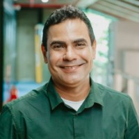
I’m Erick Mattos, CEO & Tech Lead at YAKAMI TECH based in Manaus, Amazonas (Brazil). We’re solving a complex problem: real-time environmental data sovereignty, wildfire tracking, and fluvial logistics intelligence across remote tropical biomes where heavy cloud cover and connectivity dead zones render traditional monitoring useless.
How we do it:
We build a hybrid infrastructure merging multi-source satellite imagery (NASA, Sentinel, INPE) with local edge-AI IoT sensors, CubeSats, and DePIN/blockchain data oracles for immutable reporting.
Current Status & Track Record:
Live MVP validated and supporting public-private infrastructure modeling for federal highway EVTEA studies in Brazil.
Award-winning deep-tech stack recognized by NASA Space Apps and regional innovation frameworks.
What we are looking for:
We’re currently looking to connect with:
Climate Tech & Deep Tech VCs / Angel Investors interested in early/growth-stage opportunities focused on environmental data and spatial intelligence.
Technical & Commercial Partners scaling DePIN, edge-computing, or satellite data platforms internationally.
If you’re building or investing in the intersection of AI, hardware, and climate intelligence, let’s connect! Drop a comment or message me directly.









Comments
0 comments